South Moravian Region will acquire a digital map for 235 million, facilitating the preparation of construction projects.
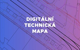 |
A digital technical map is understood to be a database file. "Based on the topographic and positional map, it displays construction and natural objects of the real world such as buildings, roads, poles, trees, and engineering networks located in the given area," stated the region's spokesperson Alena Knotková.
Roads are also included. "Part of this project involves collecting data along roads of the II and III classes using mobile mapping technology. In the South Moravian Region, nearly 4000 kilometers will be documented," said Hlavenka. Temporary control points will be created for the use of the technology. "Technology mounted on the roof of a passing vehicle will record these points and subsequently allow for precise identification by the processor. To minimize traffic disruption, control points can be created in the driving lanes of the roads by spraying two squares. Damage or deterioration of these markers will disrupt the work of the specialized company and may be subject to misdemeanor proceedings," warned Knotková.
The English translation is powered by AI tool. Switch to Czech to view the original text source.
0 comments
add comment