

 |
Rio Mapping
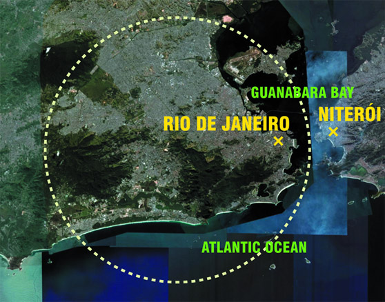
Rio de Janeiro is the second largest city in Brazil after São Paulo. Rio is the capital of the state of the same name, Rio de Janeiro. The population in Rio and its suburban areas has increased sharply in recent years and currently stands at 11,469,000 inhabitants, whereas in 1890 it was only about 1 million inhabitants (1950 - 2,930,000, 1985 - 9,086,000). According to the categorization of urban agglomerations in the article by Edward Soja and Miguel Kanai in the book "The Endless City", Rio de Janeiro is classified among the "megacity" regions with a population reaching 10 million. Furthermore, "Rio and São Paulo together form a 'megalopolitan' region. Both cities have developed through mutual connections (both physical and functional), yet on the other hand, they play different roles with distinct cultural identities in a space of increasing decentralization, socioeconomic polarization, and territorial fragmentation."
A Brief History
The Guanabara Bay was discovered on January 20, 1502 by a Portuguese expedition led by Captain Gaspar de Lemos, who named the place Rio de Janeiro (January River).The city itself was founded in this location on March 1, 1565. The location of the port was more suitable for export, and in 1763, the administration of Portuguese America was moved here from the city of Salvador (Bahia).
For almost two centuries, Rio was the capital of Brazil, from 1763 to 1822 (Portuguese colony) and from 1822 to 1960 (independent state). Between 1808 and 1821, Rio was the capital of the Portuguese monarchy. It was the only royal city on colonial American soil. Rio was the main political center of the country until 1960, when the government and state administration moved to the newly built capital Brasília on the initiative of President J. Kubitschek.
City Zoning
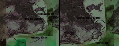
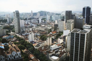
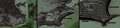
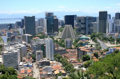
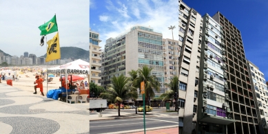
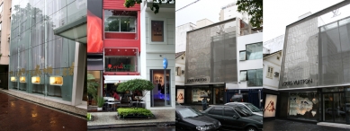
Rio is a city with unusual urban diversity, featuring beaches, mountains, skyscrapers, and ubiquitous favelas (slums) woven into the landscape. The city is generally divided into the historical center (Centro), the southern zone (Zona Sul) with its world-famous beaches, the residential northern zone (Zona Norte), and the western zone (Zona Oeste) with the newer neighborhood of Barra da Tijuca.Centro
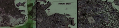
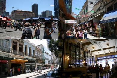
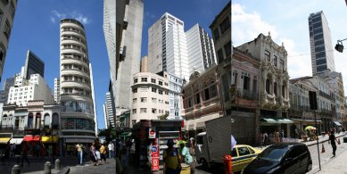
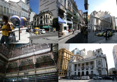
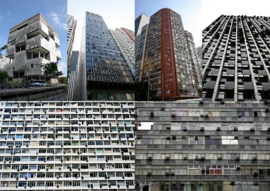
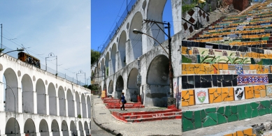
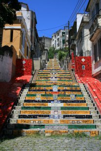
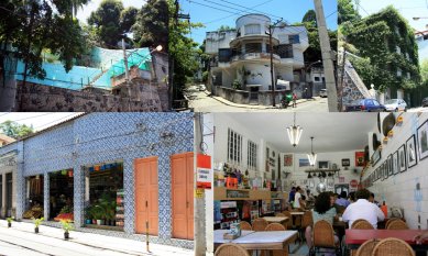
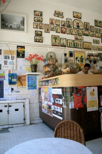
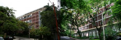
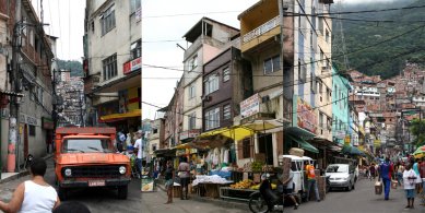
(Centro, Castelo, Cinelândia, Lapa, Saara)In close proximity to Santos Dumont airport (domestic flights) and the port (passenger transport) on the Guanabara Bay lies Centro, a thriving business district and the site of the first settlement in Rio (the city’s historical center as well as its financial and cultural center). It is home to many museums (most importantly the National Museum of Fine Arts and the National Historical Museum) and galleries. A place of emerging historic baroque churches and cathedrals, a municipal theater, and a national library. Exploring the colorful colonial architecture. In the 1960s, this part of the city saw an explosion in high-rise construction, predominantly on the famous Av. Rio Branco and Av. Presidente Vargas, resulting in the loss of many beautiful and historically valued buildings in the city center. However, due to this change, we now have the opportunity to see an interesting interplay and ambition of architecture from different periods in one place. Many places in the center are only accessible on foot, the most famous of which is the immediate neighboring historic area of Saara, hosting street markets, shops, and snacks. In the past, this place attracted a wave of immigrants from the Middle East and truly evokes a similar impression to visiting the medinas of the Arab world. The historical neighborhood of Lapa is currently considered the gravitational part, originally a residential area for the wealthy. Nowadays, many villas are in a state of disrepair, but the neighborhood is experiencing a cultural renaissance, with buildings gradually being renovated, giving Lapa a new identity as a place for a bohemian and young scene. Bars, samba concerts, and street parties. At the border of this neighborhood with the center, a modern and monstrous concrete cathedral in a conical shape - Metropolitana do Rio de Janeiro - was inaugurated in 1976. An aqueduct, Arcos do Lapa, was built around 1750 in the neighborhood, standing 64 meters tall, which historically brought water to the center. Later, it was transformed into a tram viaduct. The famous bondinho (historic tram) still connects the center with the Santa Teresa neighborhood (Zona Sul) today. Santa Teresa is located on one of the city’s hills. In the 19th century, it was the highest residential neighborhood, home to the upper class, who commuted to work in the center using bonde. In the 60s and 70s of the last century, many bohemians and artists moved to this neighborhood and its fine villas, initiating a revitalization process that continues to this day.
Zona Sul
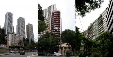
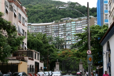
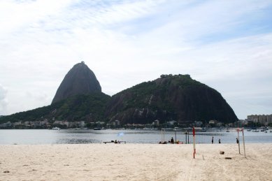
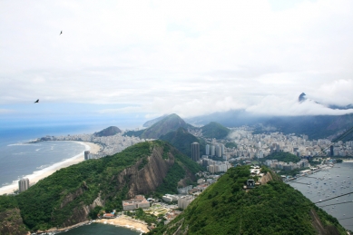
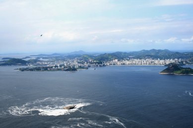
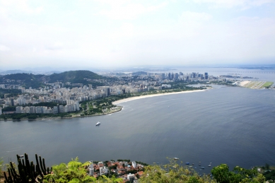
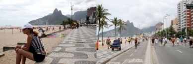
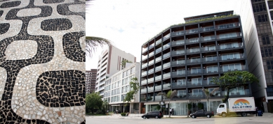
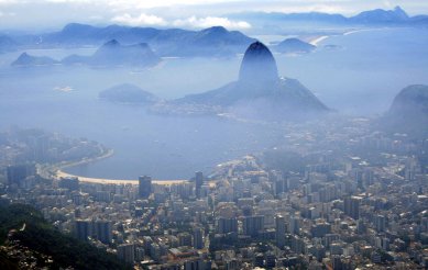
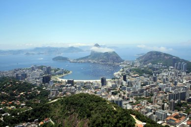
The southern zone of Rio generally consists of neighborhoods located at the entrance to Guanabara Bay (Catete and Glória, Flamengo, Botafogo, Urca and neighboring Santa Teresa, Cosme Velho, Laranjeiras, Humaitá) and then neighborhoods along the Atlantic Ocean shore (Leme, Copacabana, Arpoador, Ipanema, Leblon and neighboring Gávea, Jardim Botânico, Lagoa).Botafogo and Flamengo are areas that do not reach the sensuality of Ipanema and the decadence of Copacabana, yet they are the most traditional neighborhoods of the city. Flamengo hosts one of the largest urban parks in the world with a scenic beach (though unsuitable for swimming). Until 1904, when the tunnel to the Copacabana neighborhood was completed, Flamengo was the best residential neighborhood. After that, the upper class began migrating to the southern parts of the city. At the time of the Portuguese royal court’s presence in Rio in the early 19th century, many mansions and splendid villas were built in Botafogo, an area with comfortable access to the bay, many of which still stand today. Currently, it is predominantly a residential neighborhood for the middle classes, with streets full of greenery. Ubiquitous old-school restaurants, historical and juice bars, cafés. South of Botafogo lies the neighborhood of Urca, which is limited by the shape of the Pão de Açúcar (Sugarloaf) mountain. Urca was the site of the first Portuguese crews. Today, it is a calm and safe residential neighborhood with an eclectic mix of various styles and a sailboat harbor. A cable car leads to the "sugar loaf," providing views over a large part of Rio and the city of Niterói on the opposite side of the bay.
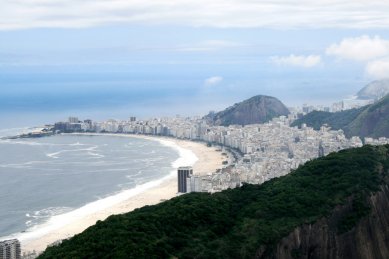
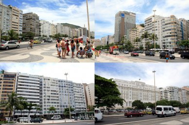
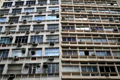
The period from the early 20th century until the late 1950s was a golden era for Rio. With the opening of the two hotels Glória (1922) and the neoclassical Copacabana Palace (1924), Rio became a romantic-exotic destination for international high society celebrities. The neighborhoods of Copacabana and Leme serve as a refuge for the most famous 4.5-kilometer-long beach. Copacabana is also one of the most densely populated places in the world, with over 25,000 people per km² packed into a narrow strip of land along the shore. The neighborhood is a mix of contrasts, chaos, and beauty. The beach bordered by luxurious hotels and residences is only a few blocks away from the presence of favelas. Exhibiting art-deco, various neo-styles, modernism, and contemporary architecture against the visceral backdrop of poverty at the foot of the mountains. Arpoador is the point where Copacabana meets Ipanema. Ipanema and Leblon are considered the most popular and expensive destinations in Rio, suitable for residences of young and wealthy Cariocas. It is a busy place full of various activities with a vibrant nightlife. Venues at ground level for the gathering of a new generation of artists, musicians, and intellectuals. Stylish restaurants, bars, bookstores, cafés, museums, chic shops, and design boutiques of both local and imported brands.
North of the Ipanema and Leblon neighborhoods are the calm neighborhoods of Gávea, Jardim Botânico, and Lagoa, which stretch around the man-made Lagoa Rodrigo de Freitas lake. The path around the lake for pedestrians and cyclists is 7.2 kilometers long.
Zona Norte
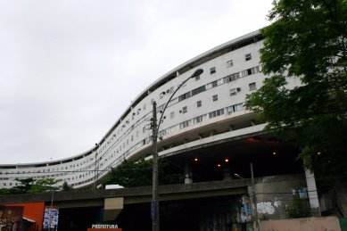
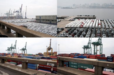
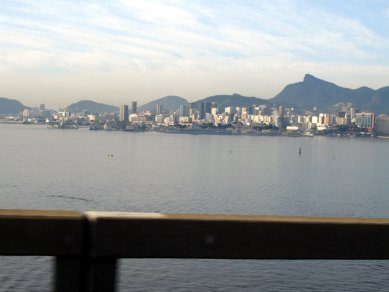
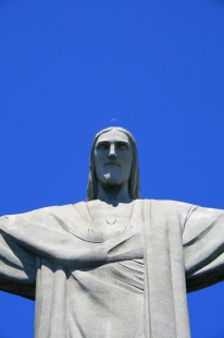
To the west and north of the center lie the nearest neighborhoods of this industrial and residential zone for the middle and lower classes (São Cristóvão, Maracanã, Tijuca, Estácio and Cidade Nova, Santo Cristo, Cajú). In the 19th century, São Cristóvão was a suburb and home to nobility, including the royal court, but today it is one of Rio's most populous suburbs. In the extensive Quinta da Boa Vista park, there is a historical Imperial palace, which now houses the National Museum. North of the park is the largest weekend market in Rio - Fiera Nordestina, and to the south are the neighborhoods of Maracanã (home to a football stadium, one of the largest in the world, capable of accommodating up to 200,000 visitors) and the adjoining Tijuca, which is predominantly a residential neighborhood (middle class) leading to the foothills, where the Tijuca National Park, a rainforest, is located, and at its peak, Corcovado, stands a 38-meter-high statue of Cristo Redentor with open arms, gazing over the center and southern zone. The peak is also one of the most attractive spots with views over almost the entire city, drawing crowds of tourists. In the Cidade Nova neighborhood, which borders the center, the famous Sambodróm, designed by O. Niemeyer, has been built, where the annual carnival takes place. To the north of the São Cristóvão neighborhood lies the neighborhood of Cajú, which is on the Guanabara Bay coast and hosts a cargo port. From this neighborhood, the President Costa E. Silva bridge leads to the city of Niterói, from which one can see the panorama of Rio. Further north lies the island of Ilha do Fundão, home to the Federal University of Rio de Janeiro, and then the larger island of Ilha do Governador, which contains the Galeão international airport.Zona Oeste
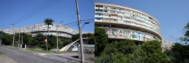
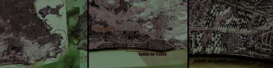
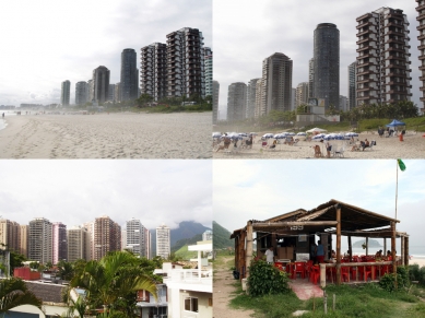
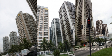
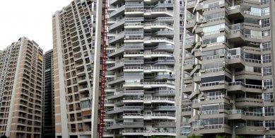
The western zone is the furthest part from the center of Rio de Janeiro. The most recognized neighborhoods are Barra da Tijuca, Jacarepaguá, Recreio dos Bandeirantes, Bangu, Campo Grande, Realengo. Within the entire zone, there are social differences between the various parts. Both industrial and agricultural zones exist here. West of the older parts is Barra da Tijuca, with residential expansion on previously unoccupied coastal land, and new construction is still present. It is a place of accelerated growth, attracting both wealthier residents and companies with notable names. The urban planning was developed under the guidance of Lúcia Costa in the early 1960s and mixed family home zones with residential skyscrapers, reminiscent of American suburban urbanism. High-rise apartments and extensive shopping centers evoke more of Miami than the crowded center of Rio. For the Pan American Games in 2007, the Pan American Village was built here. The beach itself along the Atlantic coast is 12 km long, the longest in the city, and is also attractive to residents from the city center. This area becomes increasingly less urban as one moves west, gradually transitioning into unspoiled natural landscapes.
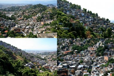
Favelas (Slums)
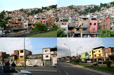
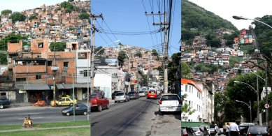
There is a great disparity between the poor and wealthy residents of Rio. A relatively large portion of the population lives in modest conditions and poverty. The poorest areas are the slums, known as favelas, often crowded at the foot of the mountains, where it is problematic to build solid structures leading to frequent landslides due to heavy rains. Most favelas are electrified, but often electricity is illegally tapped from the public grid. Various materials are used for building houses, from bricks to waste. Favelas are often densely packed into small, narrow spaces. They are plagued by waste, crime, and hygiene issues. It is estimated that one in four Cariocas currently lives in favelas. A unique aspect of favelas in Rio is their immediate proximity to wealthy parts of the city. Upper-class neighborhoods like Ipanema and Copacabana are squeezed between beaches and mountains, the foothills of which are covered with an architectural patchwork. In the past, there was an effort to push the poor out from the center to the suburbs, but it was more suitable for them to live closer to the center with easier access to work. The largest favela, with a population of nearly 150,000, is Rocinha, which grew west of the Leblon neighborhood at the foot of the mountains. The neighborhood is a complex network of social groups and individuals, with problems predominantly addressed within this fascinating community. It is currently considered the most developed favela in Rio. Electrification, internet cafés, local TV channels, schools, and other "amenities" thanks to social programs initiated in the last decade are now a given.
Transport
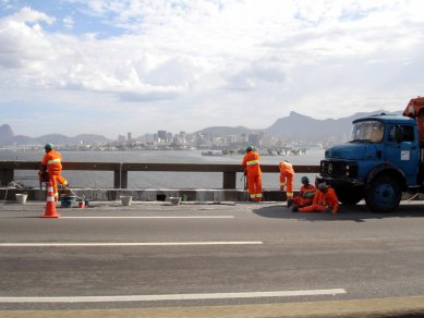
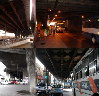
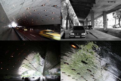
The city has dense automobile traffic, which, given the large distances between various parts of the city, seems to be the most advantageous and fastest means of personal transport. The transportation network is quite well developed, and the barriers created by the mountains of Rio are overcome by numerous tunnels. Almost everywhere, one-way roads with two or three lanes are proposed, significantly speeding up the flow of traffic, which at times is dizzying. In some parts, traffic is managed in three levels above each other, but due to the density, traffic jams occur frequently. Among public transport, buses are most widely used, with nearly 440 lines transporting over 4 million passengers daily. However, there is no scheduled timetable for departures, as we are used to in Europe, and navigation relies solely on numbers and names of terminal stations, which significantly complicates orientation for tourists. At times, you might travel to the same terminal station taking a route that is twice as long or slower, depending on the number of the line. Rio has two metro lines stretching 42 kilometers with 32 stations. Extensions of the existing lines are under construction. Local train lines in the suburbs connect to these fully utilized metro routes. In the future, a third metro line is planned to connect the cities of Rio de Janeiro and Niterói via an underwater tunnel across the bay.
Date of Travel: 01 / 2008
Location: Rio de Janeiro, Brazil
The English translation is powered by AI tool. Switch to Czech to view the original text source.


0 comments
add comment