

MMR proposes to abolish the mandatory visual standard for the graphical format of spatial plans
 |
According to the Czech Chamber of Architects, the amendment would simplify the graphics of documentation, reduce the costs for municipalities and regions, and at the same time preserve the benefits of digital transformation. However, representatives of local governments view the proposal skeptically. They argue that abolishing the unified standard could lead to confusion, and the amendment could also be contrary to the building law.
According to MMR, the regulation adjusts, for example, the requirements for the content of spatial analytical materials and their scope and form for regions. It also establishes a unified standard for spatial planning documentation, defines built-up areas, and territorial measures, and sets requirements for a machine-readable format of spatial studies. According to the explanatory memorandum, the amendment should reduce graphical requirements. The unified graphical standard would subsequently be methodologically defined but would not be legally enforceable. The option to submit spatial plans in certain digital formats should also be removed.
The chairman of the Czech Chamber of Architects, Jan Kasl, criticizes the efforts of the previous MMR leadership to unify graphical marking. According to him, it is impossible to achieve graphical unification of spatial planning for more than 6,000 different settlements in the republic.
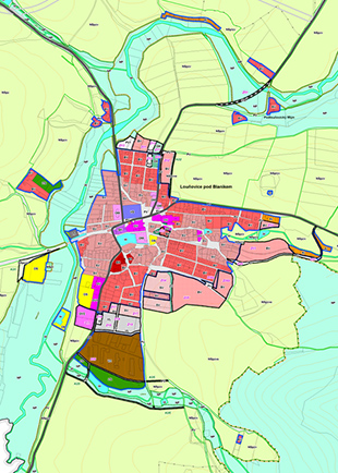
"The same plan for Ústí nad Labem and Louňovice under Blaník will not contribute to their development at all. When standardizing and digitizing spatial plans, it is necessary to draw from professional practice and data, not just unify the graphical appearance of the plans," Kasl stated in a press release. According to the vice-chairman of the chamber's board, Petr Lešek, the amendment would save municipalities money, as they would not have to invest in establishing a unified standard.
However, according to the Association of Local Governments, the amendment in practice will result in the National Geoportal for Spatial Planning displaying plans one way, but they may look different in the municipality. Thus, a citizen may end up with two different versions of the same spatial plan. This issue would not only affect citizens but also, for example, builders of linear structures. They would then have to navigate through the documentation of municipalities, each of which displays the plan differently.
"Moreover, if we had to choose the real problems of today's building proceedings, it certainly would not be the graphical standard. Far more pressing is the functionality of the National Geoportal, the digitalization of building proceedings, the preparation of a new regulation for spatial planning, or the lack of a data standard for acceleration zones," the association stated on its website.
The National Geoportal for Spatial Planning, like other building systems launched last year, is facing difficulties. The obligation to use it has been postponed due to its technical condition after the approval of the so-called bypass until mid-2026.
The English translation is powered by AI tool. Switch to Czech to view the original text source.
0 comments
add comment